


App Update 3.0: Even More Productivity-Boosting Features
We’re extremely excited to be sharing a brand new version of the Moasure app – 3.0. Our sleekest app update yet, 3.0 is packed with powerful, productivity-boosting enhancements to make your measuring, viewing, editing, and exporting experience even better than ever.
This free app update has been designed with you in mind, further elevating your measurement processes thanks to new upgrades such as: Area Calculator, Colour Layers, Scale Grid and Marker, 3D Contour View, Label & Ignore Points when measuring, new CAD exporting options, and a whole host of other updates.
Here’s a quick video overview to see what’s new in 3.0:
Major Updates:
Label & Ignore Points as you measure
In addition to labelling and ignoring points after you’ve completed your measurement, you can now label and ignore points each time you pause whilst measuring – saving you the hassle of having to document key features of the job site after the fact.
When you capture a pause point and the device is stationary, two buttons for labelling and ignoring points are available on the canvas, allowing for convenient annotation and editing whilst paused on the job site.

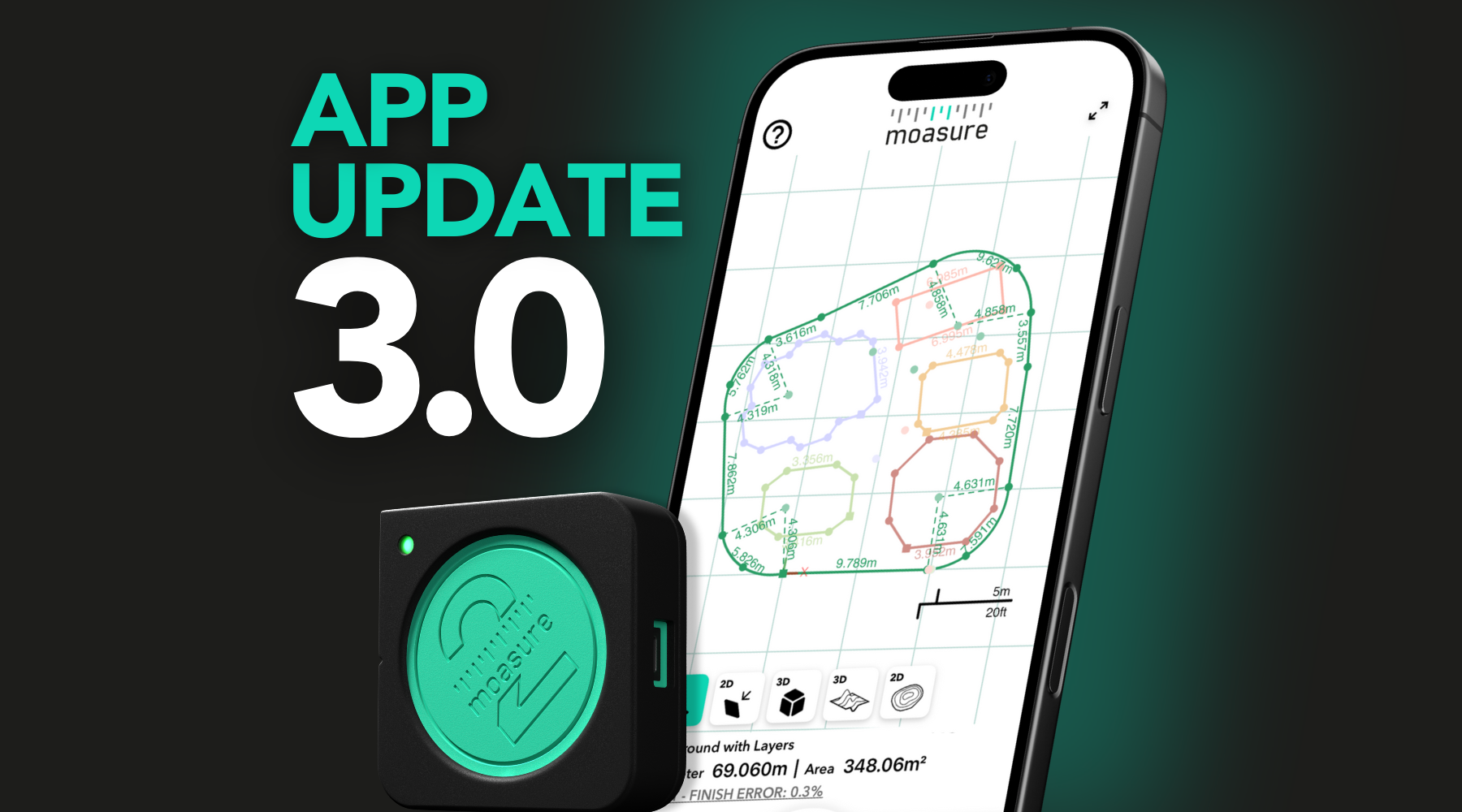
Area Calculator for Layers
The highly-requested Area Calculator enables you to automatically calculate net areas between multiple layers within your diagrams, streamlining complicated calculations. Simply drag and drop to calculate across different layers to achieve your desired data.
For example, this feature could be useful when you need to determine the area of multiple spaces, whilst still detracting specific parts – such as landscaping minus planting areas, or subtracting a pool to calculate the deck area.

Colour Layers
Keep track of each individual layer with the new customisable colour feature. Assign different colours to key zones of interest, assisting you when reviewing your project and making your diagrams even more eye-catching.

Scaled Grid & Scale Marker
See the scale of your measurements with the new scaled grid and scale marker in 2D modes, putting your measurements on the map. Configure your grid format via Display Settings and tailor to your preferences using the following options: No Grid, Ground Plane (No Scale), Major Lines, or Major and Minor Lines.

3D Contour View
Brand new to 3.0, is being able to toggle your Contour map view between the regular 2D projection, as well as the new 3D projection, enabling you to visualise elevation changes and terrain gradients in greater detail.

New Volume Calculation Methods
Now when you inspect your volume measurements, you can choose to have the volume calculations based on either the Lowest Point Plane, or Perimeter Plane.
The Lowest Point Plane uses the very lowest point within the measured area as the baseline for volume calculations, as if it was filling up the entire space from the deepest point, right up to the edges. Lowest Point Plane is useful for enclosed areas such as pools, ponds, or excavated spaces.
Compared to Lowest Point, the Perimeter Plane uses the outer boundary of the measured area as the reference point, as if it was creating an invisible flat surface under the edges of the measured space. Perimeter Plane is beneficial for calculating stockpile volumes or mounds sitting on relatively level ground.

Smooth Z & Actual Z
Have greater control over how you view your Trace Line path elevation data, with the new Smooth Z and Actual Z options. This functionality enables you to adjust the elevation data for better accuracy and clarity.
Smooth Z flattens the captured elevation data on your diagram (such as movements to avoid handrails or plants), while Actual Z denotes the accurate and unfiltered vertical path taken when using Trace Line.

Export CAD files with points
We’ve now made more data available to you when you export your files to CAD. Captured points – as recorded in the Moasure app – are now inspectable DXF Point objects (as opposed to just lines). In addition, new coloured layers will also carry their colour over to CAD software when exported from the app, ensuring an even more detailed visualisation.
This change to exports ensures that your exported CAD files are more reflective of your measurement points, and are transferred to your CAD software as such – streamlining the viewing and inspecting element of the measuring process.
Plus, ignored points can also be exported as a separate layer with an on/off toggle within CAD software.

Multi-Layer Surface Fitting
Make layering different surfaces easier with our update to Layers measurements. For example, you’ll now be able to create a whole layer for elevation points, instead of having to keep them in the same layer as your perimeter. You’ll then be able to visualise this change in 3D Surface View.

New Theme
We’ve updated our colour theme in the app, and polished up our display to make your measurements look even more professional. In both light and dark mode, you’ll notice some new colourways to keep your measurements looking sleeker than ever.

Minor Updates
Point-to-Point PDFs
Now, you can export Point-to-Point measurements as scaled PDFs, adding to the number of measurement exporting options we provide to users. Perfect for including in reports to send to customers or colleagues.

Backgrounds in 2D Contour
Adding a background image to Contour View in 2D is also available, helping you to contextualise your site – much like how you can with the existing 2D Plan View and 2D Fit View.
New view animations
We’ve added in some new transitions between the 2D and 3D views, ensuring a seamless experience when you change your measurement projection. If you switch between two similar projections, the view will remain synchronised.
Switch between 2D & 3D quicker when measuring
As you’re capturing measuring points, you can now click the selection of 2D and 3D icons to conveniently switch between different views.
With all of these beneficial free features coming your way in 3.0, make sure to keep your Moasure app updated via the App Store and Google Play Store! For more information on these individual features, head over to our User Guide.
Discover more about what you can do with the Moasure 2 Series here.