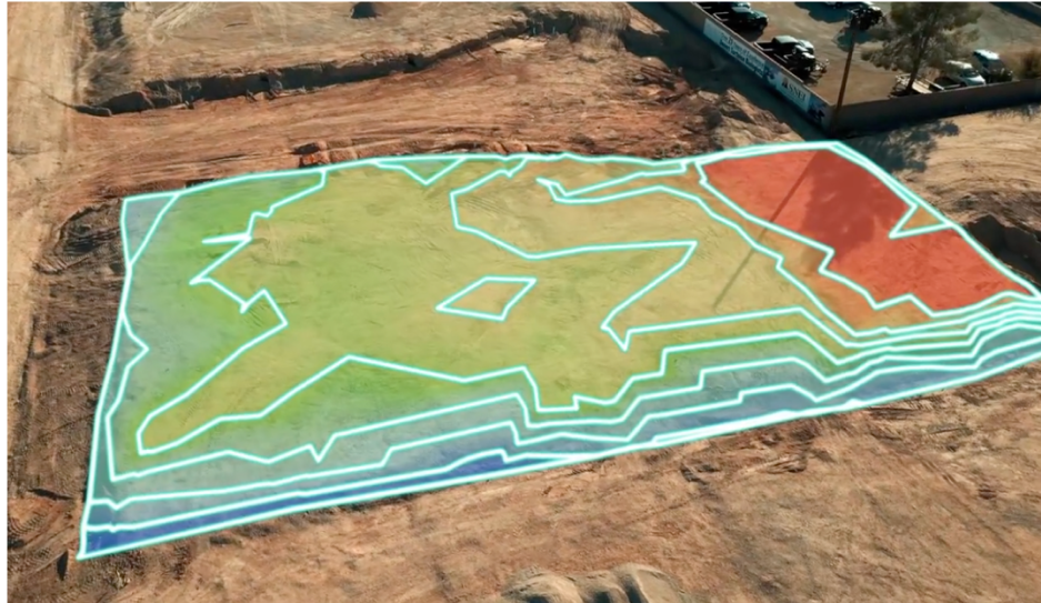

Volume
Map 3D terrain & calculate volume
Generate 3D terrain maps, calculate true surface area, volume, and contour lines.
Choose your Moasure

Try it with our 60-day money-back guarantee
How it works
Rapidly generate an accurate 3D terrain map of any space
Plus, make earthwork projects more efficient and profitable using the in-app Cut & Fill and Add Depth tools.
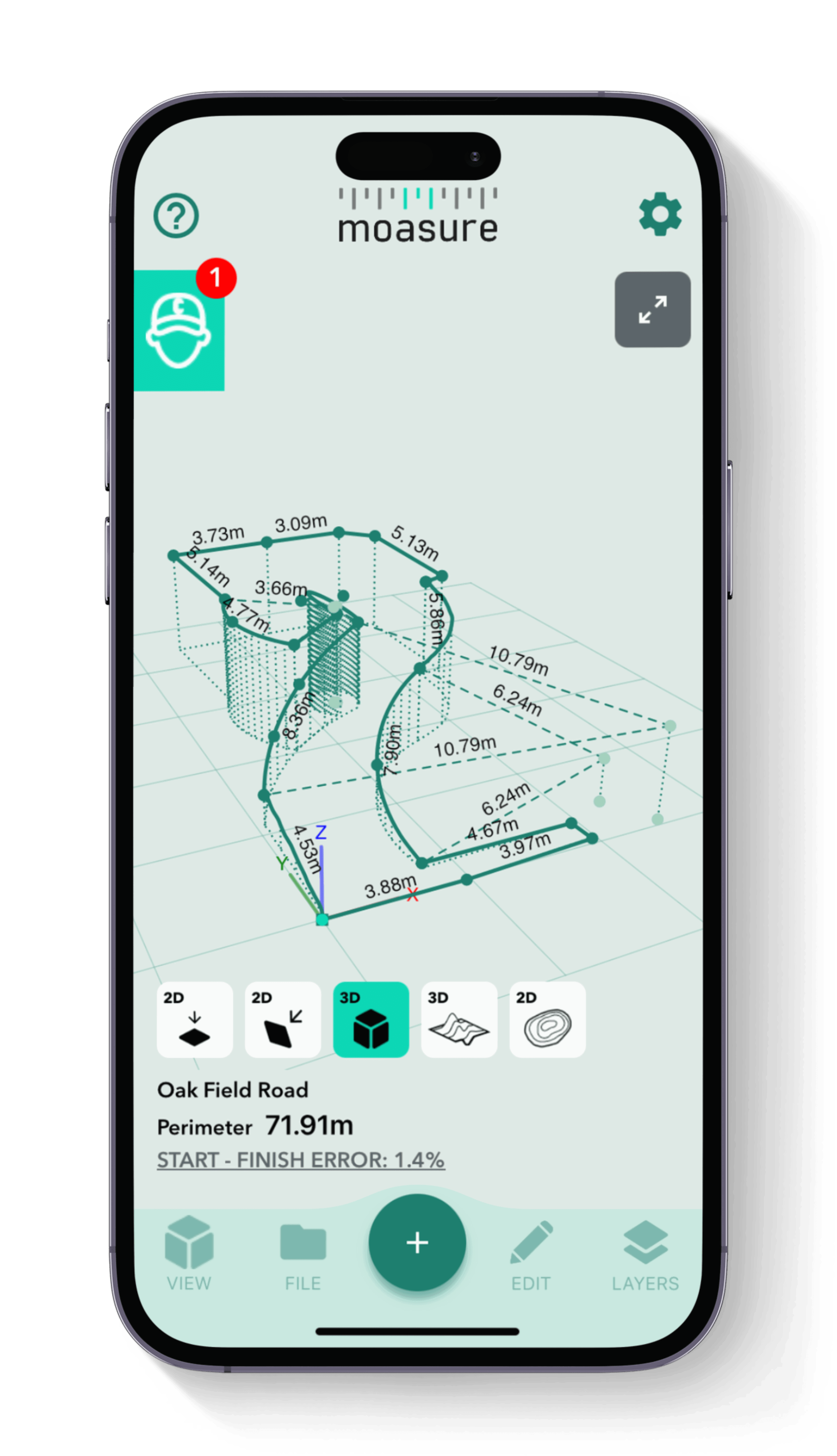
Measure 3D terrain & topography with various views
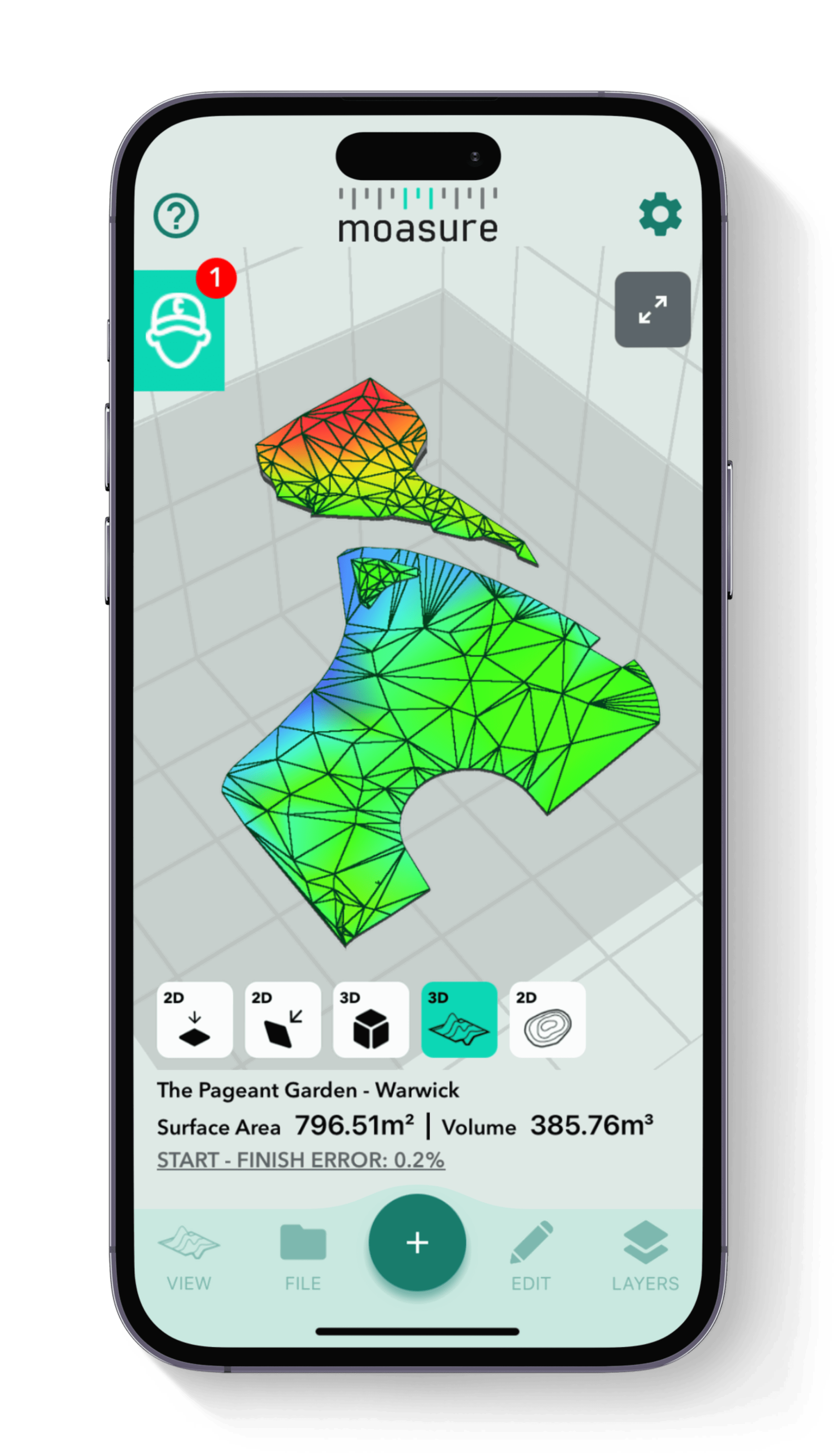
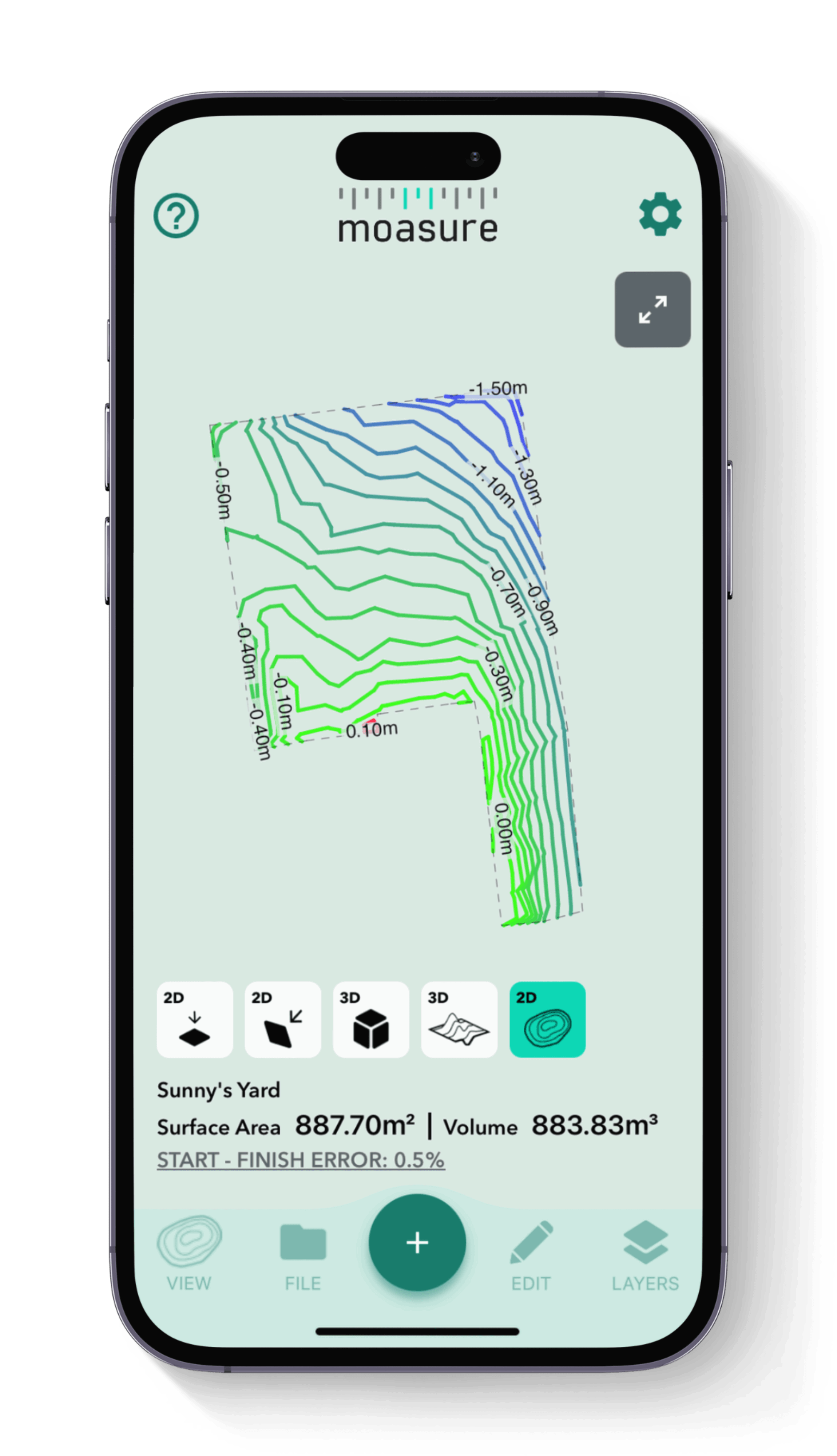
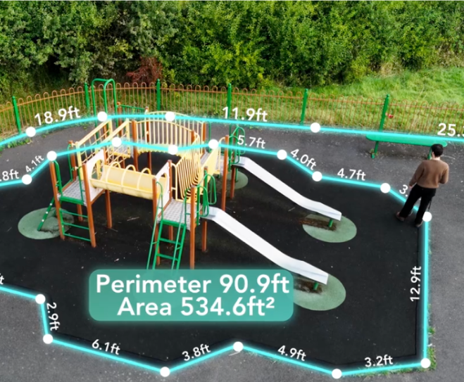
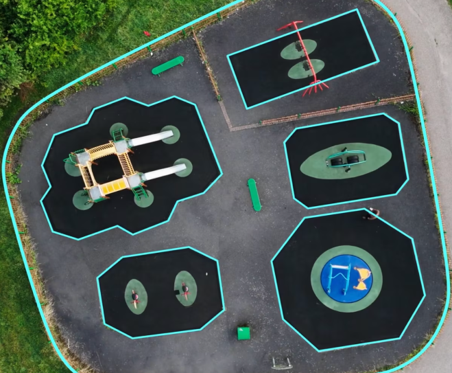
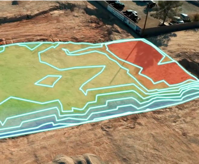
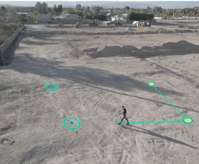
By simply moving Moasure around a job site, stockpile or excavation area, Moasure instantly captures the volume and surface area. See your 3D data in multiple ways, like surface mesh and contour views, to further enhance your measurements.

1

1

2

2
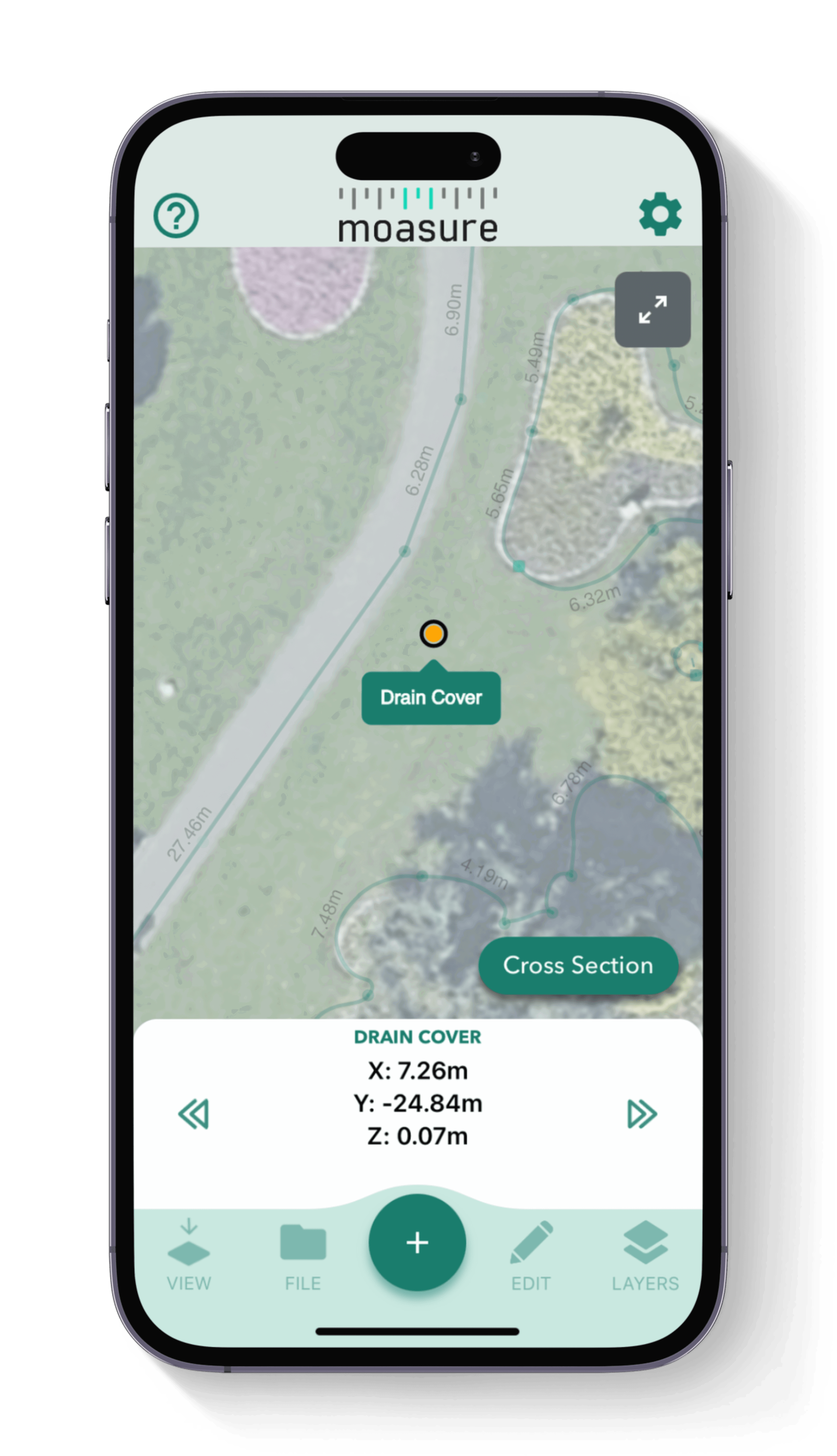
True surface area calculated instantly
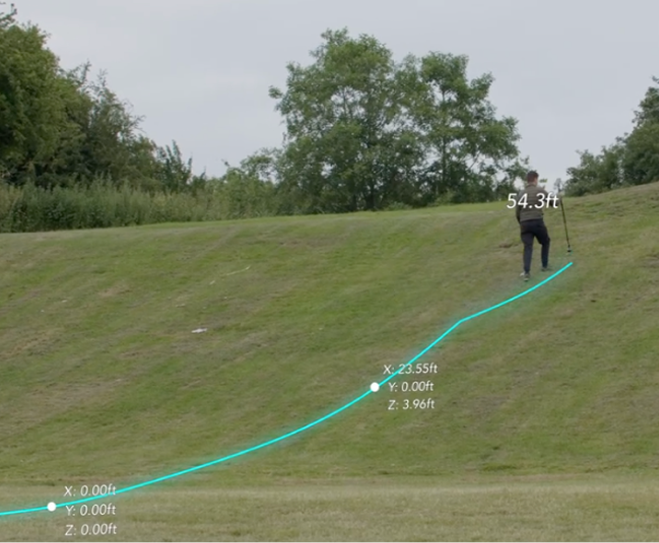
Moasure's ability to capture additional points using the Points path type allows for quick measurement of undulating sites, determining the true surface area effortlessly.
Measure stockpiles & calculate remaining material
Eliminate guesswork and scrap the complicated tools when it comes to estimating stockpile volumes. Use Moasure to calculate material volumes, prevent shortages or overages, and streamline your supply chain.

3

3

4

4
Utilise various in-app volume tools
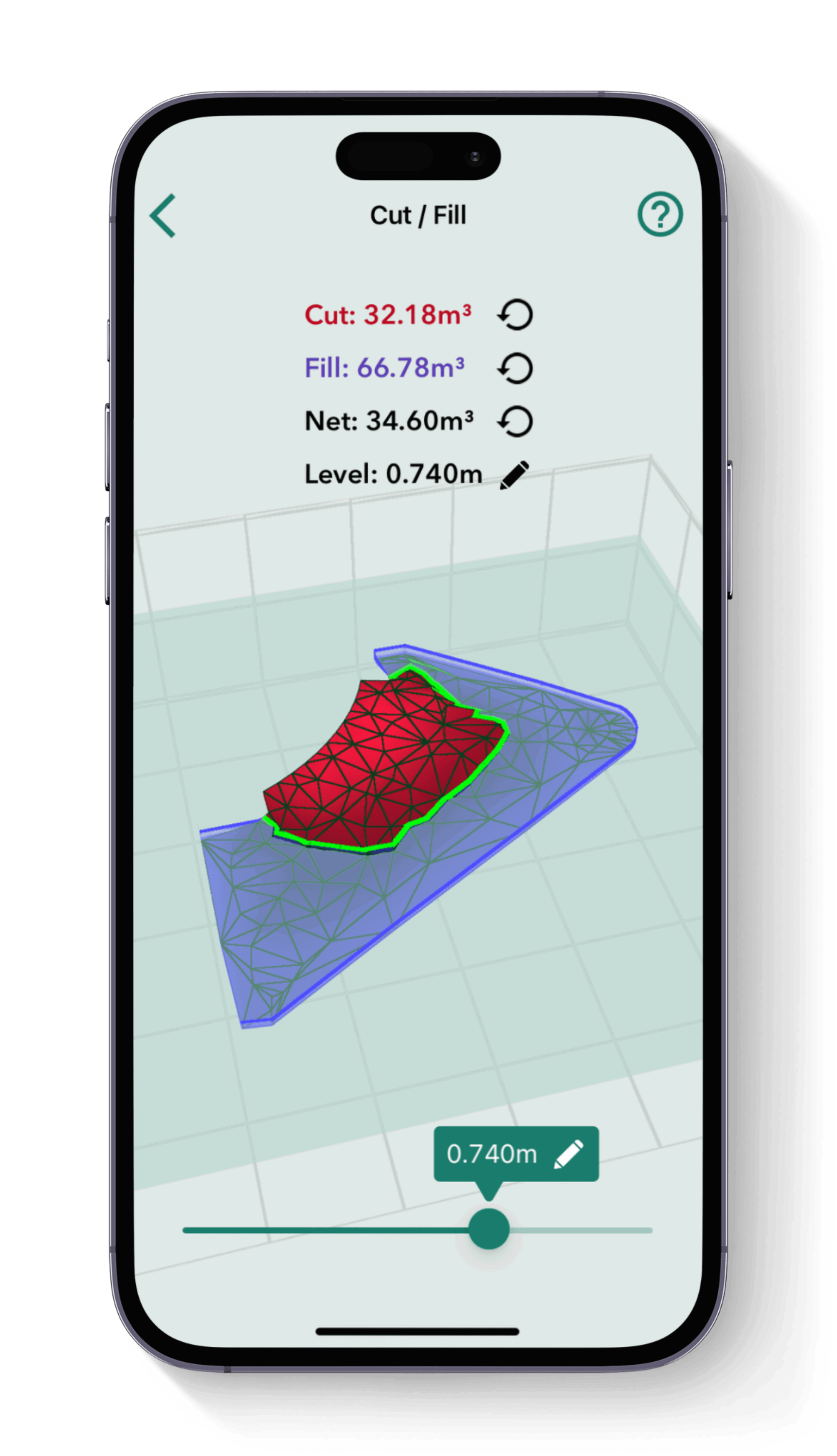
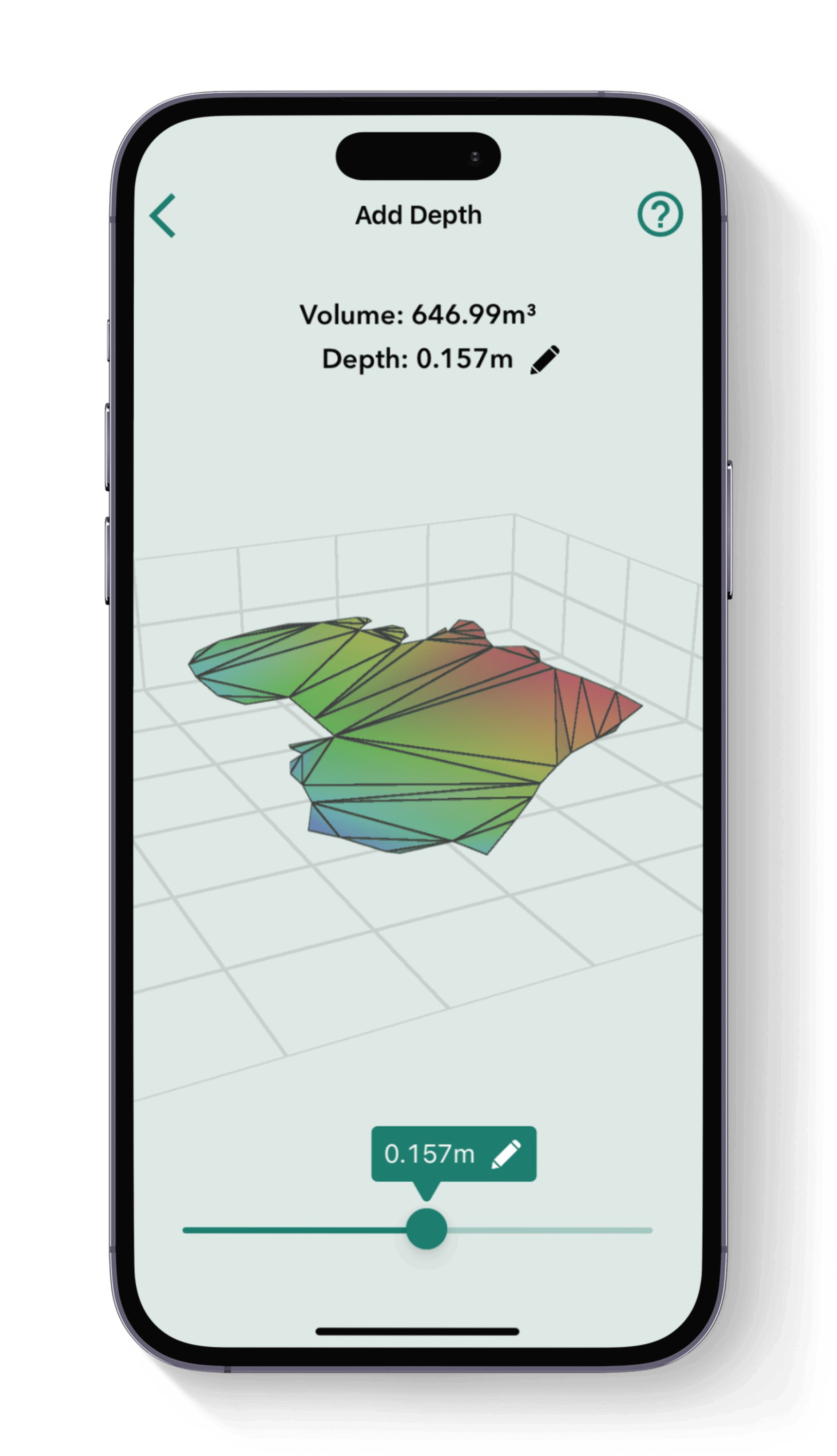
Moasure makes levelling or adding depth to an area easy. Using the built-in tools, calculate the volume required to cut or fill for site levelling, or even calculate net zero volume. Add depth to any measurement using the simple slider.
Export your volume measurement data in 3D
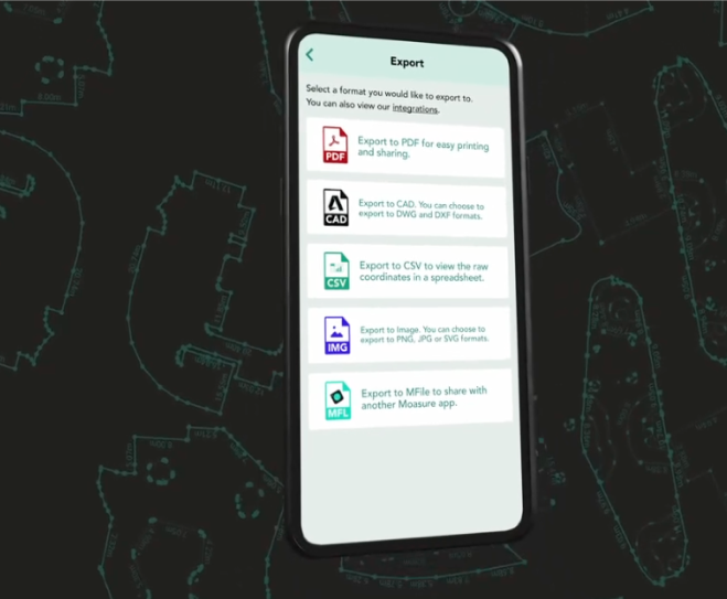
When your measurement is complete, export your volume data directly into your preferred CAD software or as a PDF, CSV, or image file. Moasure integrates seamlessly into your existing workflow, making it easier than ever to share and present accurate 3D data.

5

5



Save on material waste, maximise profits, & eliminate errors
Try Moasure today and experience the savings firsthand.
Choose your Moasure

Try it with our 60-day money-back guarantee
The easiest way to measure volume across any terrain
Watch this short video to see how easy it is to measure in 3D using Moasure.
Choose your Moasure

Try it with our 60-day money-back guarantee
TOOLS
Utilize a range of volume tools
Utilize the Moasure app's powerful suite of tools and features to inspect and enhance your measurements.
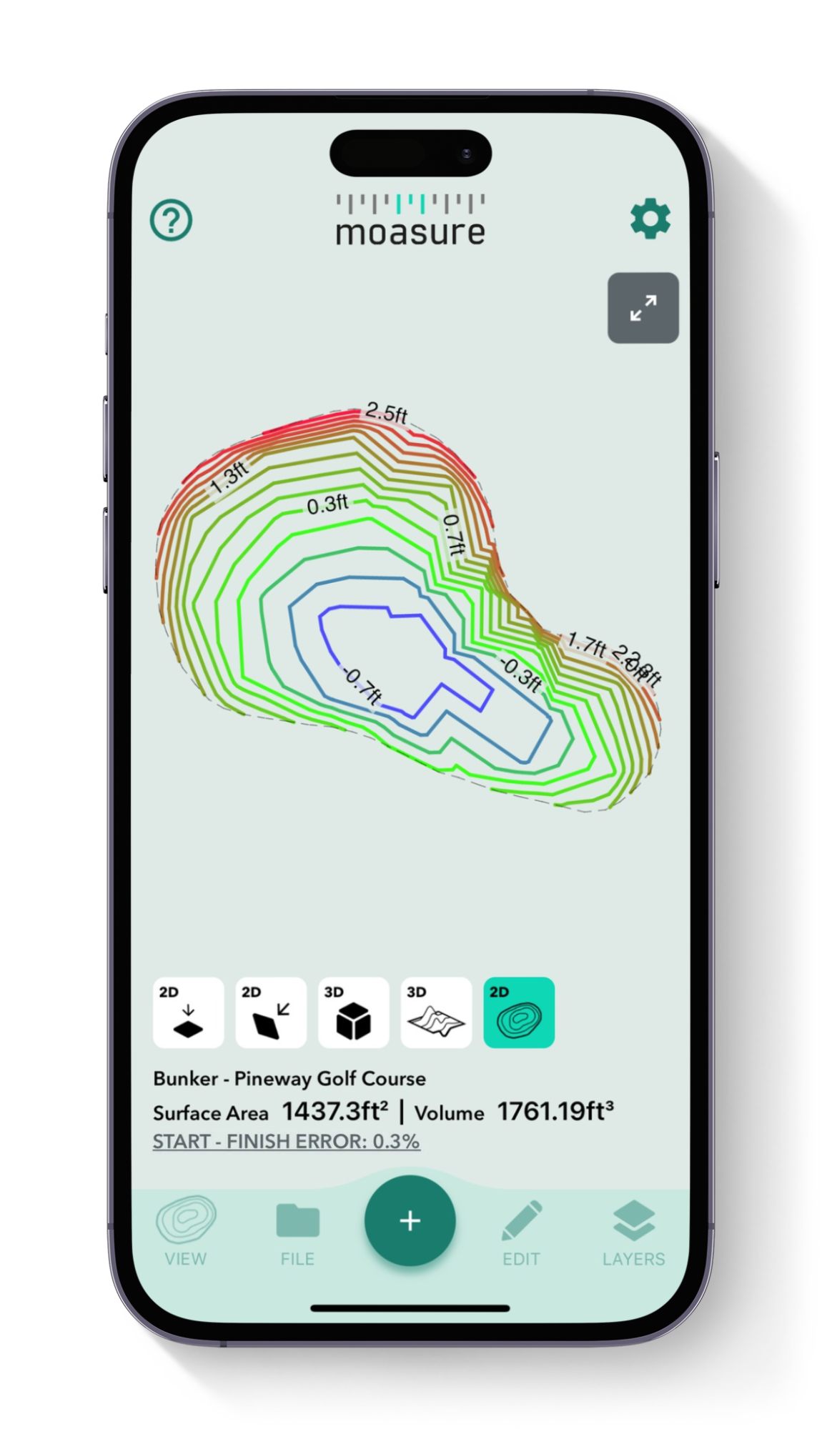
Topography/ Contour View
The contour view provides a 3D visualization of the site’s topography. By capturing elevation points across the terrain, Moasure creates contour lines that show gradients and elevations. This helps you understand site slopes and visualize the entire area, aiding in planning and material requirements.
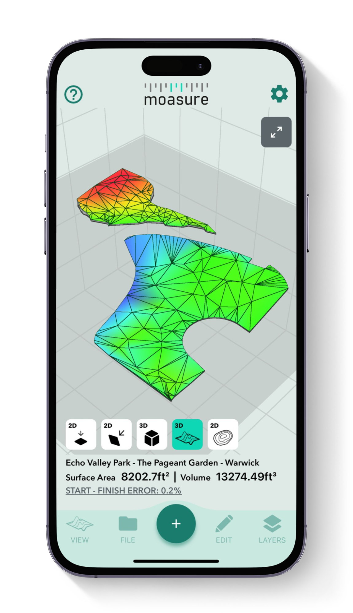
Surface Mesh View
This view generates a 3D surface map based on the measured area’s shape and elevation data, offering an accurate representation of irregular terrain. It’s particularly useful for applications where terrain and elevation variations impact planning, such as earthworks or landscaping projects.
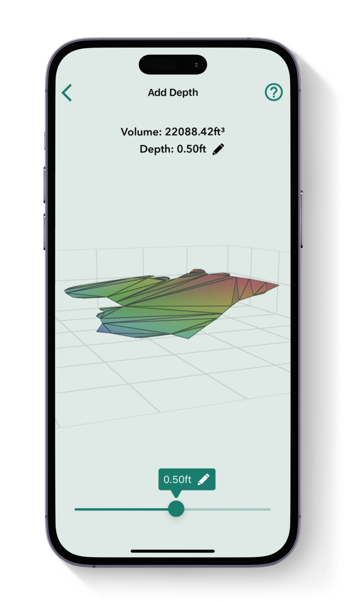
Add depth
Designed for estimating material volumes based on specific depths, this tool calculates how much material (like mulch, soil, or aggregate) is needed to cover a given area at a set depth. It’s effective for both flat and sloped sites, helping you avoid overestimating material costs and ensuring precise coverage.

Cut & Fill
Calculate the volume of material needed to either excavate (cut) or add (fill) to bring a site to the desired level. Set your preferred level and instantly see the volume required for adjustments. The “zero net volume” feature shows the exact level needed to avoid any material movement, making it useful for leveling sites in landscaping and construction.
Powerful in-app tools
Utilise the Moasure app's powerful suite of tools and features to enhance your measurements.
Testimonials
Hear real stories from customers using Moasure
Over 90,000 professionals already love using Moasure to quickly map 3D terrain and calculate volume, saving them thousands of dollars in material ordering each year.
Why Moasure outperforms traditional tools
Unlike other tools on the market, Moasure captures the precise x, y, and z coordinates of every point and automatically calculates the volume of any area.
Automatically calculate volume on areas
Add depth to measurements for material orders
Calculate true surface area
Automatically calculate cut & fill for site leveling
Automatically create a topography map
Ability to measure irregular shapes

Measuring
wheel
Laser
level
Tape
measure
Choose your Moasure

Try it with our 60-day money-back guarantee
Frequently asked questions
Everything you need to know about using Moasure to measure volume.
Moasure 2 PRO has a volume measurement error of ±1.5%, offering up to 98.5% accuracy with great user technique. This means that if you measure a 100m³ area with an uneven surface for example, the volume calculation could be out by just 1.5m³.
In comparison, Moasure 2 has a volume measurement error of ±3%, providing up to 97% accuracy. This means that if you measure a 100m³ area with an uneven surface, the volume calculation could be out by 3m³.
Choosing the right Moasure device for you will depend on the level of accuracy you require for your projects.
Yes, Moasure works on various materials by capturing elevation changes. You may find it easier to take Moasure out of the STICK in order to place it more easily on certain surfaces.
Yes, Moasure captures x, y & z data for each point you capture. All of this data can then be exported to DXF or DWG, ready to use across a wide range of CAD applications.
You can also use Moasure to generate detailed, scaled PDFs, edit data with CSV exports, or visualise measurements using PNG, JPG and SVG formats.

CHOOSE YOUR MOASURE RISK-FREE
100% money-back guarantee
Every Moasure device is tested to ensure it meets our accuracy and precision standards.
Plus, every order comes with a 60-day money-back guarantee as standard.
Thousands of professionals have transformed their workflow with Moasure.
Give it a try and you’ll never look back.

Choose your Moasure

Try it with our 60-day money-back guarantee
MOASURE FEATURES
See what else Moasure can do
With a range of professional features available, learn more about each one here.

